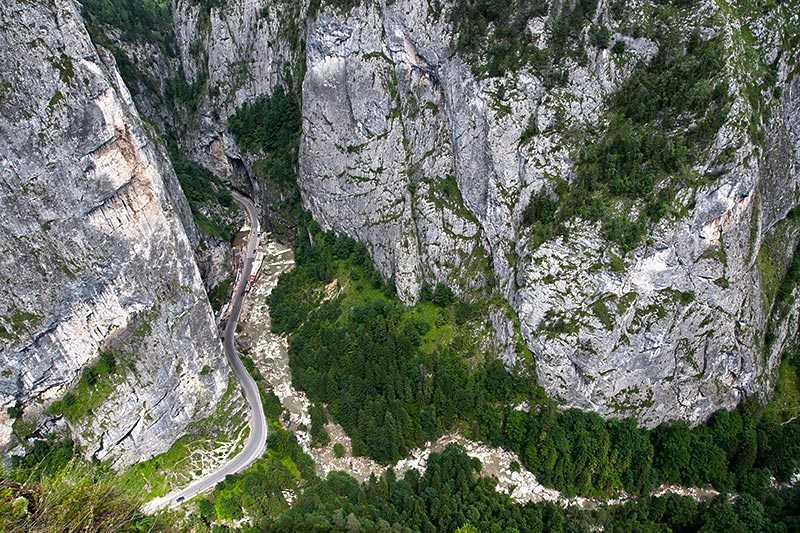
Ceahlau Massif
About Ceahlau Massif
Ceahlau Massif is part of the Bistrita Mountains range located in the Eastern Carpathians in Neamt county, Moldova. Its highest elevations are Ocolasul Mare Peak a...
About Ceahlau Massif
Ceahlau Massif is part of the Bistrita Mountains range located in the Eastern Carpathians in Neamt county, Moldova. Its highest elevations are Ocolasul Mare Peak at 1,907 m (~6,257 ft), closely followed by Toaca 1,904 m (~6,247 ft) – Toaca is most visited as Ocolasul Mare Peak is closed to the public. As well as being a highly popular hiking destination, the ar...
Attractions near Ceahlau Massif
Activities
About Ceahlau Massif
About Ceahlau Massif
Ceahlau Massif is part of the Bistrita Mountains range located in the Eastern Carpathians in Neamt county, Moldova. Its highest elevations are Ocolasul Mare Peak at 1,907 m (~6,257 ft), closely followed by Toaca 1,904 m (~6,247 ft) – Toaca is most visited as Ocolasul Mare Peak is closed to the public. As well as being a highly popular hiking destination, the area is also renowned for the many myths and legends which have grown up surrounding the strangely shaped stones and boulders that are scattered over its slopes.
Fauna and Flora
The national park within which the massif lies hosts many protected plant and animal species. Its 1,097 recorded plant species represent 30% of all flora found in Romania, including 61 that are protected by law, like edelweiss. Among the diverse fauna are green and grey toads, the black eagle, the chamois, the bear and deer.
Tourism
The area is still largely undeveloped for tourism, guaranteeing enjoyment of nature at its best without too much commercialisation. There is a small fee for entrance to the national park.
Activities
The Ceahlau Massif is a popular hiking destination in Romania with highly picturesque mountain and valley scenery. There are seven main marked trails, running from the small village of Izvoru Muntelui, the spa and winter sports town of Durau (which has ski slopes in winter) and from Ceahlau itself.
Camping is permitted only in a few designated areas: in Durau, Izvorul Muntelui and near Dochia Chalet which stands at an elevation of 1,750 m (~5,741 ft) near Toaca Peak.
How to Get There
Reach the Ceahlau Massif from either the village of Izvoru Muntelui, 12 km north from the town of Bicaz; or from Durau.
Warnings
Some hiking routes are closed in winter due to adverse weather conditions. Check restrictions locally as there may be fines for not complying with the park’s regulations.
